| Weather Data--NFW | |||
|---|---|---|---|
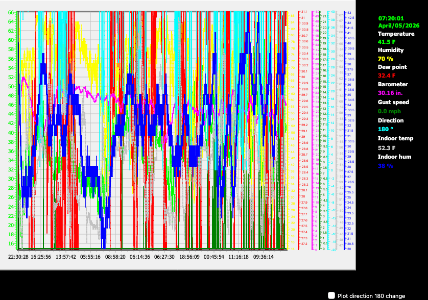
| LAST READING AT TIME: 1:40 PM DATE: July 23 2026, time of next update: 1:41 pm | |||
| Current Weather | Night time/Dry | Current Temperature | 95.4°F (35.2°C) (Heat Index 92.7°F ), Apparent temp 97.6°F |
| Maximum Temperature (since midnight) | 96.1°F at: 1:33 PM | Minimum Temperature (since midnight) | 61.3°F at: 6:12 AM |
| Average windspeed (ten minute) | 0.1 mph | Wind Direction (ten minute) | SSW (202°) |
| Heat Index | 92.7°F | Maximum Gust (last hour) | 3.0 mph at: 1:26 PM |
| Maximum Gust (since midnight) | 3.5 mph at: 11:22 AM | Maximum 1 minute average (since midnight) | 2.3 mph at: 11:22 AM |
| Rainfall (last hour) | 0.00 in. (0.0 mm) | Rainfall (since midnight) | 0.00 in. (0.0 mm) --- |
| Rainfall This month | 0.24 in. (6.0 mm) | Rainfall To date this year | 13.69 in. (347.7 mm) |
| Maximum rain per minute (last hour) | 0.00 in/min | Maximum rain per hour (last 6 hours) | 0.00 in/hour |
| Yesterdays rainfall | 0.00 in | DewPoint | 50.5°F (Wet Bulb :69.0°F ) |
| Humidity | 22 %, Humidex 98.0°F | Barometer corrected to msl | 29.685 in. (1005.3 hPa) |
| Pressure change | -0.02 in. (last hour) | Trend (last hour) | STEADY |
| Pressure change (last 12 hours) | -0.02 in | Pressure change (last 6 hours) | -0.07 in |

Use the RELOAD facility on your browser to retrieve the latest data.